Hydrologic Impacts
All Hydrologic Impacts are shown below
Hydrologic Impacts
Increasing urban density reduces natural area, causing more rainwater to collect and flow faster over land. When water cannot flow quickly enough (because it is obstructed by the urban environment), it will overflow onto land that is normally dry. Heavier rains mean higher risk that property will flood.
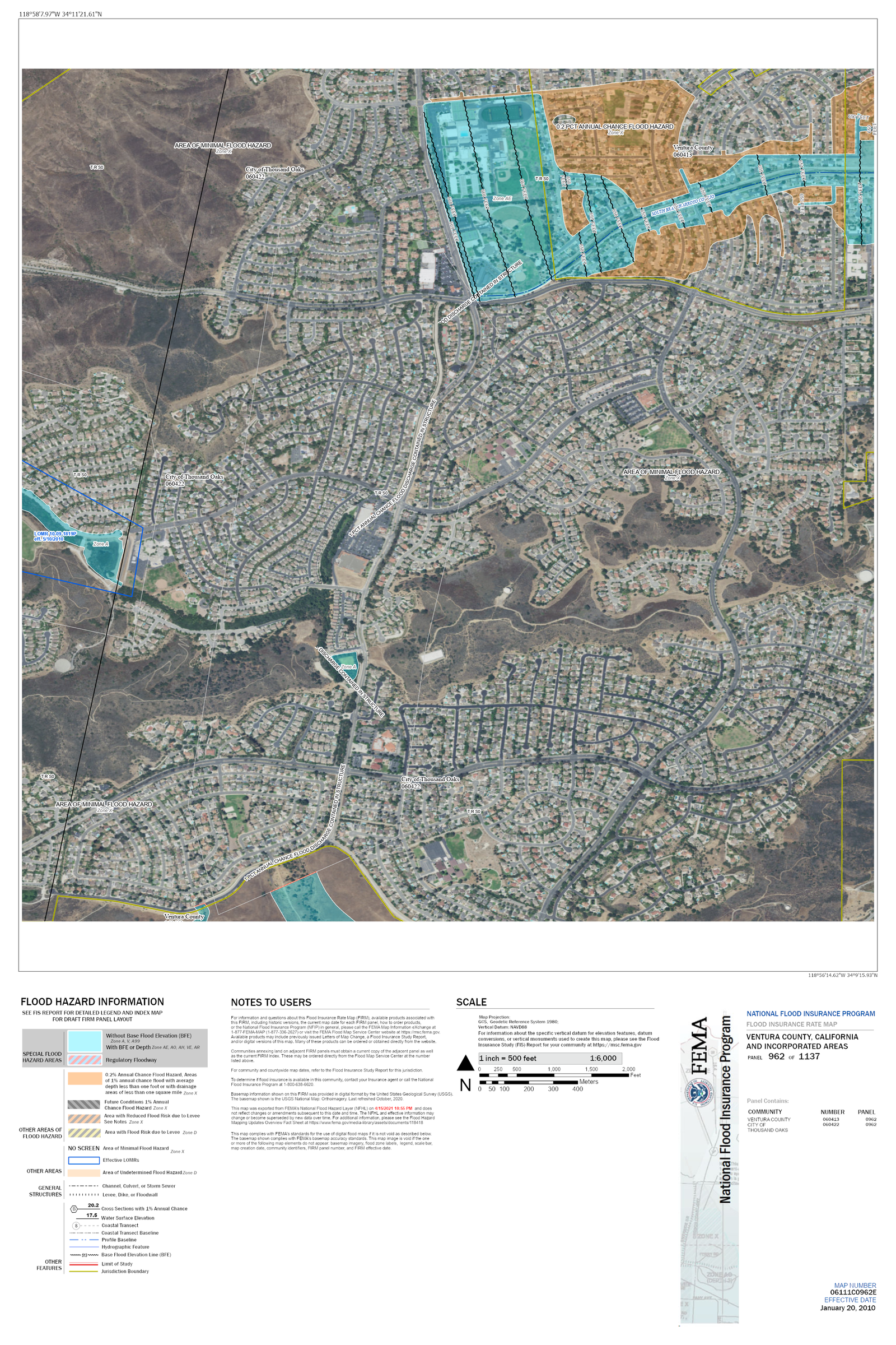
Flood Hazard Areas in Newbury Park

Areas in blue (Zone A) show the extent of flooding, which has a 1% chance of being equaled or exceeded in any given year. This is the same probability as flipping a coin 10 times and getting 9 heads. Areas in orange (Zone X) have a 0.2% annual chance of flooding. These areas are also known as the 100 year and 500-year floodplains. A 500-year flood has worse consequences than a 100-year flood.
Anyone who owns property in a 100-year floodplain and has a federally backed mortgage is required to purchase flood insurance as a condition of their mortgage (source: floodsmart.gov).
Extreme Flooding Can Occur Several Years in a Row
The occurrence of a 100-year flood event does NOT guarantee that people are ‘safe’ for the next 99 years. For example, the City of Houston recently experienced three 500-year floods three years in a row:
2015, 2016, and 2017 (sources: The Washington Post, CBS).
Our nation has experienced at least 25 of these 500-year storms since 2010 (source: National Weather
Service). In fact, the National Climate Assessment has recognized that heavy downpours are becoming
more common nationwide.

Figures showing (a) yearly total number of water-related billion-dollar disaster events in the United
States and (b) the associated costs (source: National Climate Assessment).
Mitigating the Flood Hazard
The South Branch Arroyo Conejo drains an area of 6,740 acres from South Potrero Rd. and Dos Vientos Ranch to the S.B. 101 Freeway at the Borchard Rd. exit. Runoff flowing into storm drains makes its way to the South Branch Arroyo Conejo and ultimately to a double box culvert at the freeway exit. Because the culvert cannot drain more than 5,000 cfs, any excess flow will lead to ponding. The same thing happens with a bathtub faucet flowing faster than the bathtub can drain—the water level rises because water is flowing in faster than it can flow out. This can lead to flooding of local streets and eventually homes. For perspective, a 10-year storm (10% annual chance) has an estimated flow of more than 5,000 cfs. A 100 year storm has an estimated flow of 6,880 cfs. Worse yet would be the 500-year storm. Storms this severe have happened before and will happen again. It is not a question of if but when. Reducing the risk of flooding is a matter of timing, and this requires a detention pond. Ventura County placed a flowage easement on an undeveloped 36.5-acre parcel of land located between the South Branch Arroyo Conejo and the 101 Freeway. When flow in the channel reaches 4,500 cfs, water flows onto the arcel. Thus, the 36.5-acre parcel acts as a detention basin because of the flowage easement.
Removing the Detention Storage Would be Devastating and Costly
Over 300 homes are currently within the mapped FEMA 100-year floodplain. Presently, the County’s flowage easement helps provide 100-year flood protection to these properties because of flood detention. Removing this detention storage could be disastrous, flooding property and restricting access by emergency responders. Fully developing the 36.5-acre parcel, as the City’s re-zoning proposes, would require millions of dollars-worth of improvements to the South Branch Arroyo Conejo.